Bingie Residents Association Past Projects
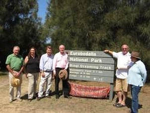
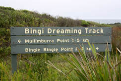
The Bingi Dreaming Track
|
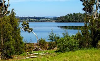
The Bingi Dreaming Track was established to provide a scenic and interesting walk along an ancient Aboriginal Dreaming track from Congo to Tuross Head. The Track joins with a coastal walk from Moruya Heads to Congo which gives a continuous coastal walk to Tuross Heads. One of the most distinctive features of the walk are the Intermittently Closing & Opening Lake and Lagoon Systems (ICOLLS) which add significantly to the biodiversity of the coastal region.
For more on the Aboriginal background to the Dreaming Track see HERE Now that the Bingi Dreaming Track is in operation (see NSW National Parks), many alternative tracks degrading the bushland have been closed and these areas are naturally regenerating. The track has been well used by a large range of groups and individuals who, it is hoped, gain some appreciation and knowledge of the special coastal ecosystems the walk passes through.
|
|
Key Results
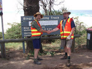
- The project involved track clearing, placement of marker posts, trackhead signs, interpretive signage and seating over 13.5km of walking tracks from Congo to Tuross Heads.
- Members of the Bingi Residents Association worked closely with The Cobowra Aboriginal Lands Council who advised on sign locations, and determined track diversion works, where necessary, to avoid significant sites. Local Elders also contributed experience and expertise to the project.
- The interpretive signs were supplied from a third grant totalling $16,900 – by BRA . These are along the existing Budjarns Track which runs from near the Bingie Point carpark to Kellys Lake.
- We also worked closely with National Parks & Wildlife Service who contributed to the project through structural works and maintenance. National Parks also provided improvements such as minor drainage works and levelling.
- The project ran smoothly with excellent support from agencies and Council.
- The first section of the track (Congo to Bingi) was opened by Gary Nairn (the then Federal Member for Eden Monaro) in January 2007 attended by about 50 people and followed by afternoon tea. The track extension was opened by local Aboriginal Elder Trish Ellis and was attended by about 60 people followed by a communal BBQ lunch.
- Our members were assisted with labour by the Tuross Lakes Preservation Group representatives, and a highlight was meeting and working with these enthusiastic group members.
- The track has been well used by a large range of groups and individuals who, it is hoped, gain some appreciation and knowledge of the special coastal ecosystems the walk passes through.
- A brochure has been produced combining Stage 1 and 2 of the Track which provides information on the landscape, flora and fauna. This brochure has been professionally produced with assistance from Cobowra Land Council, B.R.A. members and National Parks. Copies are available from National Park offices and Eurobodalla Tourism outlets (Narooma/Moruya Library and Batemans Bay).
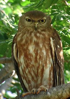
Barking Owl Survey
|
Start Date: February 2009
Finish Date: June 2009 Project Cost: $5,150 from the Australian Government Envirofund. Volunteers: 8 Key Results:
|
|
|
|
New Developments:
- Since the completion of the project, some residents have reported hearing the Barking Owl’s distinctive call on their property, and there has been a confirmed sighting of a large owl near one of these properties.
- Has anyone else heard or seen a suspected Barking Owl? If so, let someone on the committee know the circumstances.
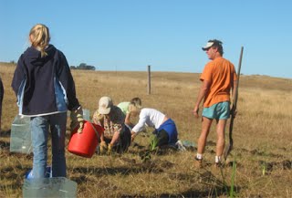
Coila Lake Foreshore Restoration
|
Start Date: February 2009
Finish Date: June 2009 Project Cost: $12,100 contributed by the Australian Government Envirofund Volunteers: 8 Key Results
|
|
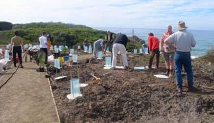
Herbarium and Seedbank
|
The herbarium will provide a botanical information resource on the classification and distribution of plants in the Bingi area, as well as data for conservation and revegetation work.
The seedbank will be a collection of local seed for long-term conservation purposes and used to support landcare and other community-based revegetation initiatives and the restoration of native plant communities. Start Date: February 2007 Finish Date: June 2009 Project Cost: $10,150 contributed by the Australian Government Envirofund Volunteers: 19 members of BRA, plus volunteer staff at Eurobodalla Regional Botanical Gardens |
|
Key Results
- Formation of a close association with staff and volunteers from the Eurobodalla Regional Botanical Gardens (ERBG), who gave invaluable help and advice with all our activities.
- Participation in three popular plant identification and collection walks under the guidance of senior Botanical Garden’s staff.
- Participation in a one-day workshop at ERBG on record keeping including preparation, mounting and labelling of specimens and electronic record-keeping.
- Participation in a one-day workshop at ERBG on plant propagation.
- Collection, recording, photographing and collating the information of numerous plant specimens, with notes on their habitat, growth and seeding.
- A much greater appreciation of the local flora and development of new skills by all who took part.
- The purchase of several reference books, most of which have been donated to the local library where they are kept in the library’s reference section and are available to the general public to peruse or study. Two publication have been donated to the ERBG and are also available for the public to view.
- Trish Ellis of the Cobowra Aboriginal Land Council proposes to organise a walk for members of BRA in return for a small publication with text, photos from the project notes.
- Collected seed will be propagated on BRA’s behalf by the ERBG as part of their own propagation work. This will be a great help in ensuring that the plants get professional care and aren’t neglected.
- A further propagation workshop at the ERBG has been financed as part of the project, with a date to be decided.
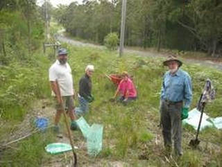
Revegetation through Implementing Landscape Plan
|
Strategic Landscape Plan 2006The Bingi Strategic Landscape Planning Project was funded by Envirofund to help our Landcare volunteers set priorities for their works. The Plan (which can be downloaded here) developed from a need to become more strategic in our approach to Landcare activities. As the time and resources of a group of volunteers and the efforts of private landholders is limited and, to a certain extent, fragile, it is important that the efforts made by those individuals is spent in the most effective way to produce the most ‘value for effort' in the management of natural resources in our area.
We sought external technical advice to help prioritise our efforts and to break these target activities into discrete projects of defined cost and quantities. The Plan provided the explanation of why we are doing particular projects in a particular order. Landholders now have a balanced and clearly defined reasons to manage their own natural resources well and to participate in community rehabilitation works which will ensure development pressures do not compromise our significant coastal ecological resources. |
|
|
Start Date: January 2007
Finish Date: March 2009 Project Cost: $7276 Funded by: Australian Govt Envirofund Volunteers: 10 Key Results
|
To download the Vegetation Map below enlarge it first.
|